Maps and Geospatial Data for Everyone
Learn More
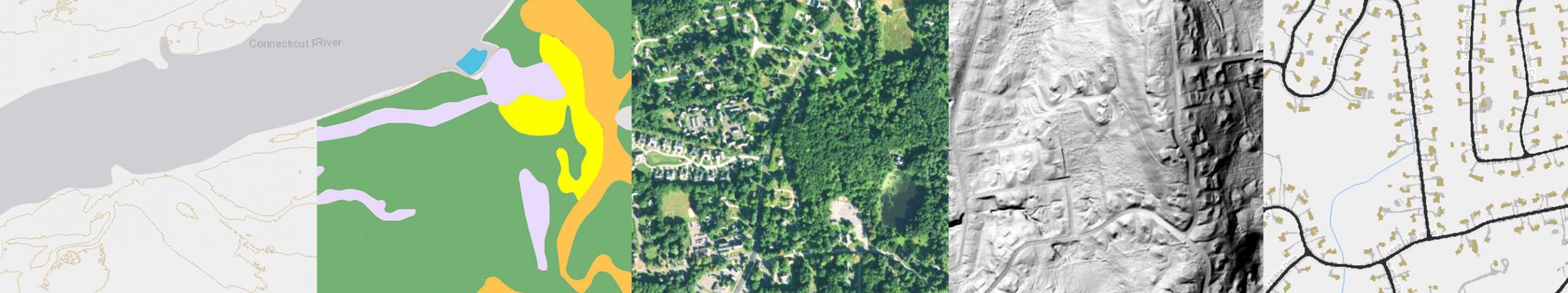
Map Viewers
view and explore maps
Map Catalog
printable static pdf maps by town
Map Services
connect to data with GIS software
Guides
information about map layers
Download
download GIS files
Help
answers to questions, instructions and tips
CT ECO News & Updates
Connecticut Soil Survey Updates – Fall 2023
Written by Jacob Isleib, State Soil Scientist The USDA NRCS, Soil and Plant Science Division refreshes the publicly available soil survey database once a year. This Annual Soils Refresh (ASR) provides new soils data, updates to existing soils data, and new soil interpretations. The ASR also ensures all official soils data adhere to the same […]
[Read More]CT ECO System Upgrades
CT ECO has received a number of upgrades this summer and there are a couple more in the pipeline. CT ECO is a system of five servers including a web server, three mapping servers, a database server, and a large storage drive. They connect to each other so that loads of Connecticut’s geographic data can […]
[Read More]New CT ECO Website
We are excited to announce the launch of the new CT ECO website!
[Read More]1934 Aerial Photography Mosaic
The 1934 Aerial Photography Mosaic created by UConn MAGIC is now on CT ECO.
[Read More]Natural Diversity Database and Aquifer Protection Areas Services
Natural Diversity Database and Aquifer Protection Areas updated services now coming from DEEP as feature layers.
[Read More]Connecticut Town Parcels
Connecticut town parcels are now available for viewing on CT ECO.
[Read More]CT State GIS Office News & Updates
Update on Imagery and GIS data
Update by Carl Zimmerman, PhD, CT GIS Office This is an update from the CT GIS Office on the production, review, and publication of the imagery and GIS data collected during the spring 2023 flight. The production is divided into four geographic blocks: Block 1 (northwest), Block 2 (southwest), Block 3 (central), and Block 4 […]
[Read More]CT Imagery Delivery Update
Hello, Emily here from UConn and CT ECO. This is a quick update to say that we haven’t received final deliverables of any of the imagery yet. As soon as we do, we will get the service up as soon as possible. Check back for more updates.
[Read More]CT Imagery Delivery Update
Written by Carl Zimmerman, PhD, GIS Coordinator, CT GIS Office (email: carl.zimmerman@ct.gov) The first wave of Imagery, Elevation, and GIS data are now being delivered to the GIS Office and are undergoing a Quality Assurance review. The imagery data we have seen so far (NW CT) looks quite good. A nice example of the quality […]
[Read More]CT GIS Office Newsletter Vol 1, Issue 2
Volume 1, Issue 2 of the GIS Office newsletter is out. It announces the new, seamless 2023 parcel layer, the 2023 Annual Report, and the new housing dashboard. It also includes updates about broadband mapping, stakeholder outreach, addressing, the strategic plan, aerial imagery acquisition update, and more. It also provides a summary of the recent […]
[Read More]CT Imagery and Lidar Delivery Schedule
Written by Carl Zimmerman, PhD, GIS Coordinator, CT GIS Office (email: carl.zimmerman@ct.gov) We are all excited about the arrival of the new data and we have received questions about when it will be available. The very high resolution and quality of both the aerial imagery and Lidar create VERY LARGE files which are time-consuming to […]
[Read More]2023 Data Acquisition Update
Hi CT GIS Community: This is Carl Zimmerman (GIS Coordinator) from the CT GIS Office, and I wanted to give you a quick update on the 2023 imagery acquisition that many of you are wondering about. After some technical and quality delays around the many buy-ups of this complicated and high-resolution data capture (e.g., Imagery, […]
[Read More]